Command Overview
Priorities, incidents, readiness and decision-support indicators in one executive view.
 REVTEKTECHNOLOGIES
Software-centric intelligence, surveillance and reconnaissance capabilities for secure situational awareness and decision support.
A secure situational-awareness and operational-coordination platform that brings geospatial intelligence, incidents, readiness, logistics, communications and accountable workflows into one controlled common operating picture.
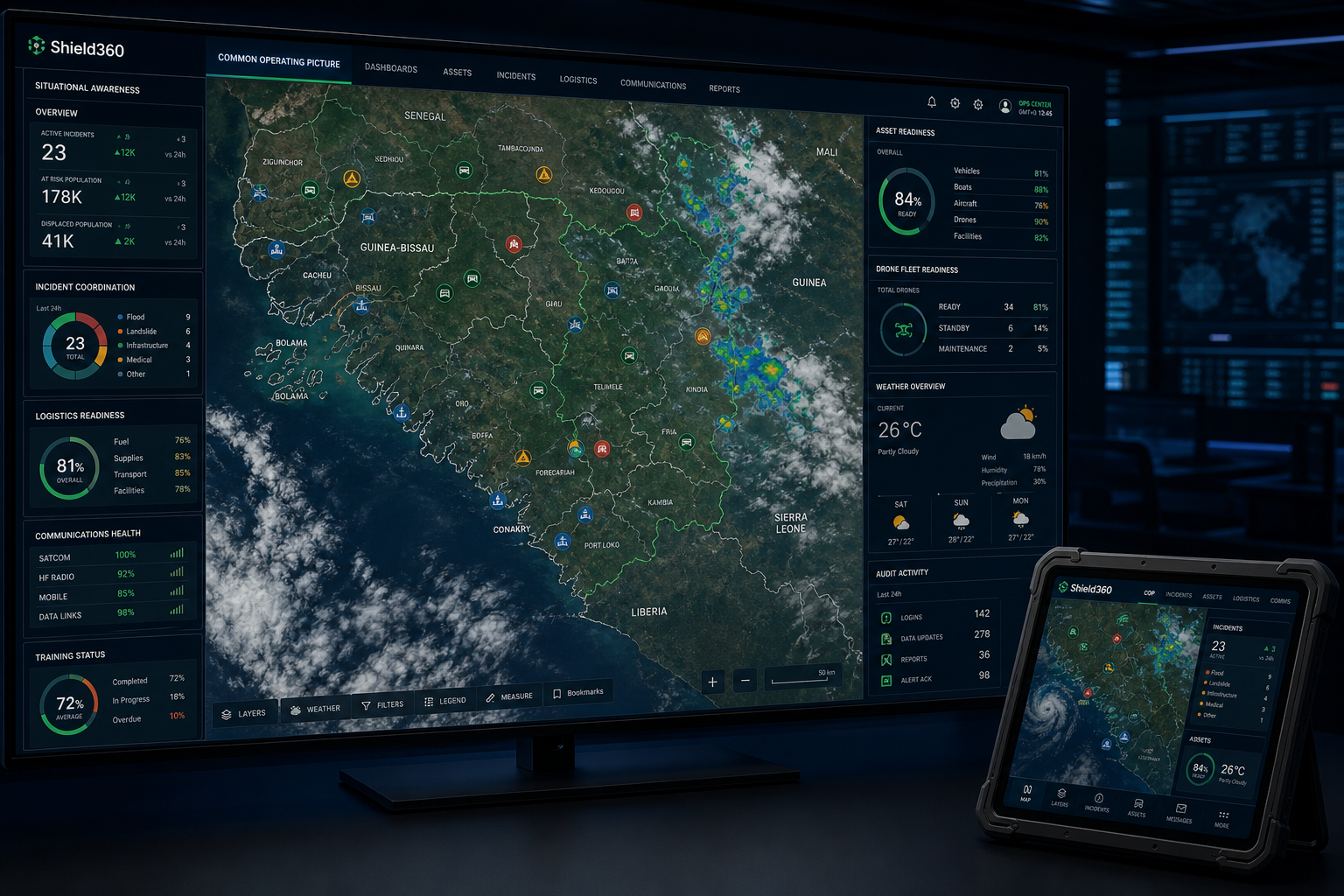
Fuse authorised reports, satellite catalogues, locations, readiness indicators and operational workflows into a role-controlled view for faster, better-informed decisions.
Shield360 can support approved imagery, data and workflow integrations while preserving access control, accountability and human decision authority.
Priorities, incidents, readiness and decision-support indicators in one executive view.
Geospatial layers, approved imagery, locations, events and evolving operational context.
Structured reporting, ownership, status, escalation and continuity workflows.
Capability gaps, inventory, maintenance, resupply and asset-readiness visibility.
Service health, role control, approvals, standards and traceable activity.
Read-only readiness, safety, mission approval and flight-record governance for non-weapon use cases.
Responsible-use boundary: Shield360 is positioned for situational awareness, disaster response, infrastructure monitoring, search and rescue, safety inspection and accountable coordination. It does not provide weapon release, target designation, autonomous engagement or direct flight-control functions.
Reports, locations, authorised sensor feeds, geospatial layers and asset status create value only when they can be fused into a coherent, secure and role-controlled operating picture.
REVTEK focuses on the software, data fusion, geospatial awareness, monitoring and workflow layer for authorised defence and security organisations.
Role-based operational views with maps, alerts, incidents and asset status.
↗Controlled mobile workflows for authorised reporting, task status and field information capture.
↗Combine authorised feeds, reports, geospatial layers and field information.
↗Controlled reporting, document movement, dissemination, search, audit and case records.
↗Integrate approved networks, servers, storage, secure access and operational software layers.
↗Track authorised assets, teams, locations and operational exceptions.
↗Integrate authorised imagery, maps and remote-sensing data into workflows.
↗On-premise, segmented or hybrid architectures aligned with security requirements.
↗Start with a short discovery conversation. REVTEK can recommend the right build, integration or automation path after understanding the operating problem.
Security and ISR environments often contain information in separate reports, maps, authorised sensor systems, incident records and databases. A useful operating environment does not simply place all of that information on one screen. It normalises the data, preserves source and time context, applies role-based access and connects information to workflow.
A common operating picture should help authorised users understand what happened, where it happened, how current the information is and what action is underway. Different roles may require different layers and permissions; "common" does not mean unrestricted.
Geospatial context adds value when it answers an operational question. Location can show proximity, area coverage, event clustering or relationships between authorised records. Time is equally important because a precise point on a map can be misleading if the information is stale.
Alerts should have a lifecycle: created, acknowledged, assigned, acted upon and closed. Systems also need to show when data sources are unavailable or degraded rather than silently presenting an incomplete picture.